
We wouldn’t blame you if you didn’t immediately associate drones with your local government. But Mecklenburg County has been using drones since 2015 and even has its own drone program.
Here are four ways staff use drones to save money and resources, keep staff and residents safe, and highlight County programs.
Seeing Stream Restorations
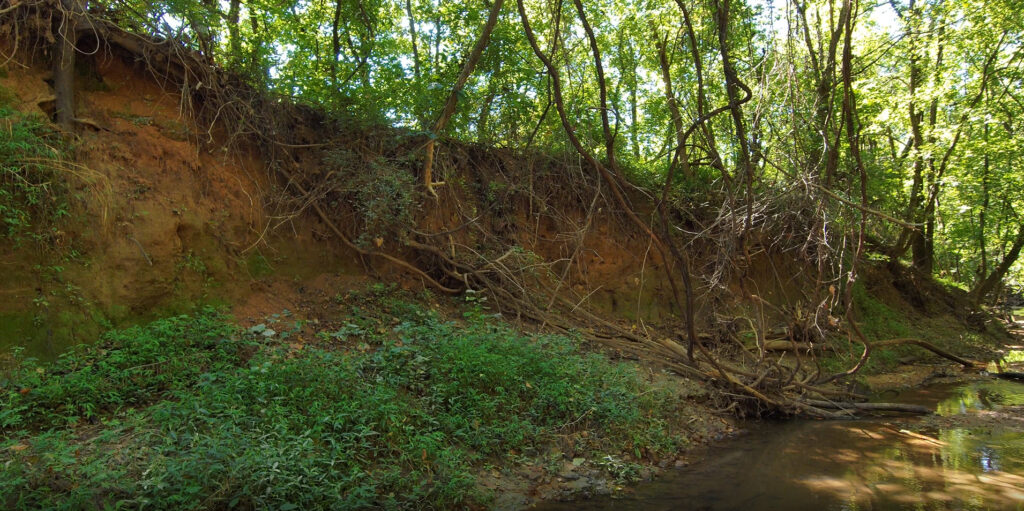
Drone footage shows a erosion in a stream pre-restoration.
Sometimes, Storm Water Services staff need permission from landowners to temporarily use their property as part of stream restoration projects happening by their home. But landowners can be reluctant to let survey and construction crews take over their yards – and understandably so! With drone footage, staff can provide 4K video of the bigger picture: how their land fits into a larger project and how it will look after completion.
“We’ve never had the ability before to show them that sequence of real conditions, what’s coming, and what it will be at the end,” said Storm Water Services environmental specialist Alex Hattaway. “It was surprising how quickly people will allow us to work on their property once they see these videos.”
Monitoring Projects
There are millions of dollars’ worth of stream restoration projects throughout Mecklenburg County. Staff monitor these restorations for years, making sure the water quality is still good, the aquatic ecosystem is still healthy, and that beaver dams haven’t caused flooding.
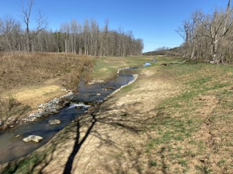
A restored stream bank.
Using drones keeps staff from having to spend hours traveling from point to point along the creek. A 30-minute drone flight can produce a 3D map, which staff analyze for beaver dams (which are knocked down to prevent flooding) or any other factors affecting the stream.
Public and Staff Safety
Staff monitor lakes monthly during the summer to make sure nature’s swimming and recreational areas are safe from potential dangers, like harmful algae blooms. To do this, staff typically have to pick up a boat from the operations center, take it to the launch point, and then navigate slowly around the shorelines of Lake Norman, Mountain Island Lake, and Lake Wylie.
By using drones, staff can cover a larger area faster – which allows them to quickly determine the extent of a bloom, where to collect samples, and where to post Swim Advisories. This helps the public know sooner if there is a threat. What would typically take an entire day can now be done in a few hours.
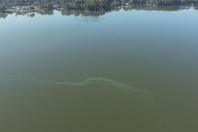
An algae bloom.
Using the drones also helps keep staff safe. Teams regularly go into Lake Wylie coves to do water level measurements. Doing this job in the summer when temperatures can get up to 100 degrees, while wearing waders and balancing on rocky shorelines, can be physically exhausting. By using a drone, staff can get the same data in 30-40 minutes – no waders required.
Showcasing The Impact of County Services

When departments need an eye in the sky to highlight their work, they call on the Public Information department. Public Information’s production team has three certified drone pilots who work with County staff to capture photos and videos of everything from how recycling facilities work, to pond dredgings, and how historic buildings are moved. Shooting these videos gives residents a different perspective of the County’s impact.
A Public Information drone ready for flight.
“They allow us to tell the story better from angles we can’t reach on foot,” said Bridget Russo, digital media producer with the Production Team.
And there is one more advantage to the program.
“Flying a drone makes me feel like a kid again,” says Stuart Wine, GIS analyst. “It’s fun to me because not only is it new, but it’s innovative and useful.”
Drones are a valuable tool in helping the County collect information so leaders and the public can make informed decisions. And as a resident, you have access to a wealth of data as well with our Geoportal! Learn more about how this tool can bring you useful information about any address in Mecklenburg County.